

|
|
An Aerial View
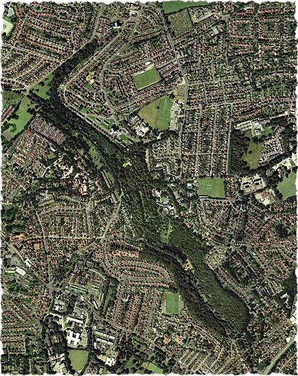
The following image is the copyright of getmapping.com who generously created this view specifically for use on the Friends of Gledhow Valley Woods web site.
This aerial photograph was taken in the year 2000. It clearly shows the woods snaking diagonally down from top left to bottom right. The area covered by this image is roughly the same as that shown on the local area street map in the Location Details & Maps section. Gledhow Valley Lake can be seen as a dark area about two thirds of the way down the Woods.
 |
|
 |